Sunday, December 6, 2009

God's Golden Shore (Well, maybe silver)


I remember the first time Lisa and I walked down a path in Cape Elizabeth. The trail took us through a mix of forest and meadow, crossing streams that flow with the deep obscuring reds of tannins released by trees into the water. We could feel the mystery that comes with arriving to the edge of the coastline - catching small currents of salt in the air when no water is in sight. The meadow abruptly stopped at a crest of grasses and the sprawling sea suddenly appeared to lay out before us. This is how we were introduced to Crescent Beach State Park in Maine. It has become a frequent stop for me to paint at, think at, nap at, play at, and get my feet soaked in it. The park has become a special and close getaway for Lisa and I to walk for an hour or two. Lying only six miles from our apartment in Portland, it's surprising how often we have the area to ourselves.
Crescent Beach State Park is a pretty literal name for the area, being a Crescent [shaped] [rocky] Beach [owned by the] State Park [system] and all. The geology of Crescent Beach State Park begins approximately 500 million years ago at the end of the Cambrian Period. An ocean covered all of Maine at that time, and the shoreline of the North American continent was located almost 300 miles to the northwest. In what is now the Portland area a great thickness of mud, sand, and limy mud accumulated on the ocean floor to form the area we now frequently take walks at. The rocks are also quite weathered looking, resembling petrified wood in their appearance.


Is this Lisa laughing in the face of death? Quite possible. Or are we simply beach nerds?


Low tide.

Just up the road toward Portland lies a area of jagged rocks and cliffs called Two Lights State Park. (All of you loyal readers out there,meaning our families, see an image from Two Lights at the header of the page every time you access this blog.) It is here that Lisa found a nesting spot in Maine - the perfected idea of a flat, hidden bed of rock that sits above the ocean but remains out of view from visitors. On sunny days when the rocks trap heat you can't even budge Lisa from this nook. It is also here, at Two Lights, where we have seen the largest waves of our lives! Sixteen foot high waves smashing into the rocks, sending spray to the level of most houses! Amidst both the turbulence and the calmer days we can always spot common eiders surfing the waves, diving for food. When the larger waves approach, some of these members of Anatidae will simply float over the crests while others dive beneath the surface, remaining visible through the pipelines.


There's that nook I spoke of.

Monday, November 30, 2009

Bradbury Mountain State Park

Please excuse the late posting of this adventure, an obvious relapase on my part as evidenced by the bright fall colors no longer existant this late in the season. Bradbury Mountain State Park was a destination suggestion of a member of the Peregrine Press, a printing co-op that Mike is hoping to be involved with.

We embarked upon Bradbury Mtn. in late October and were rewarded with magnificent views of 800+ acres of forested land dressed in bright reds, oranges and yellows stretching out towards the ocean.


Sculpted by a glacier, Bradbury Mountain itself is the park's most outstanding natural feature. A great variety of plants and animals call the mountain home and it also offers views of migrating hawks and eagles, much like Hawk Mountain in PA, except the best time to view the migration is Spring instead of PA's fall.

Before the first Europeans arrived, Wabanakis camped on the mountain on trips to the coast. In the early 1800’s, the Cotton family raised grapes on terraces still visible on the mountain. To hold stray cattle, sheep, and pigs, the early settlers built the cattle pound that still stands on Rt. 9 near the Northern Loop Trail. Near the ball field visitors can still see where feldspar was mined in the 1920’s to make crockery and china.

Acquired from the Federal Government in 1939, Bradbury Mountain became one of the five original state parks. In the 1940’s, it offered downhill skiing with a rope tow. In the 1990’s, the park added 250 acres.


The $3 to get into the park and the 30 minute drive was well worth it. We plan on doing some winter camping on Bradbury soon before I head out to El Paso!

Sunday, November 22, 2009

Scarborough Marsh

Today, the estuary is 3,100 acres and it is considered the largest salt marsh in Maine. It was once much, much larger. Imagine auburn grasses and countless birds flying over the myriad pools reflecting the mood of the sky from dawn to dusk and then at night, reflecting the stars.


The waters, influenced by the moon, cause the pools to fill and empty like giant lungs making the marsh a place of constant change. Food was plentiful for the Sokokis Indians who hunted, trapped, clammed and fished on the wetland. Then, in the 1600s, white men came and pushed out the native people, they used the salt hay to feed cattle and sheep and used the marshland as summer pasture for livestock.


With the 1900's came an apparent increased need for the destruction of the natural world, especially places that were the most beautiful and important for wildlife. True to form, ditches were dug, pannes were filled and tidal gates were installed, thus preventing the tides from doing their eternal duty by flooding portions of the marsh and bringing nutrients to the wetland. Deciding that not enough damage had been done, it was determined that channels were to be dug to allow boats built inland to float through the marsh out to sea. When haying declined in the 1900s, people began to view marshes as sacrifice areas for airports or cheap space on which to fill and build. Finally, the most brilliant plan of all for this gorgeous piece of earth - make it a town dump! That very plan was proposed in the mid 1950's, as was an airport.


Evidence of plans, now foiled, to destroy the marsh

Then some humans, apparently lacking the destroy the earth gene, decided that an important coastal wildlife habitat was threatened, and in 1957 the Maine Department of Inland Fisheries and Wildlife began the twenty-year process of acquiring the marsh. In 1972 Maine Audubon initiated a partnership with the state to convert into a nature center an old clam shack at the edge of the marsh. Now, fast forward to 2009 and Lisa and Mike arrive on the scene at Scarborough Marsh and are awe struck by the vastness and beauty of this huge wetland.


The painter in his natural habitat


We saw egrets, herons, grassland sparrows, buffleheads (Mike's new name for me). On a previous scouting mission to visit the outskirts of the marsh, Mike saw thousands of American Eels congregating around a deep pool, writhing and wriggling all over, he said it was awesome to see! Apparently, muskrat, mink, otter and snowy owls frequent the marsh but we weren't lucky enough to see those this time.


Wednesday, November 18, 2009

Stars on Monhegan Island

Maine is a state for artists and Monhegan Island boasts an extraordinarily dense population of the rare, elusive and often cranky species. The light that glimmers and glints off the rocks that encircle this 1.75 mile wide island makes the place twinkle like stars in the daytime and the preserved wilderness areas that blanket the interior are gorgeous and can be seen via 17 miles of hiking trails.


Sunlight off island on the way to Monhegan

Mike was lucky enough to see extra stars as we were leaving the island when three middle aged women with glorious bosoms flashed the boat. Yes... it was a good day, for an artist. Monhegan has been a destination for us since we arrived in Portland and visited the Portland Museum of Art to view a Mainecenntric exhibition entitled, 'Call of the Coast: Art Colonies of New England'. Ever since Mike has had a glint in his eye to see the island on which the illustrious likes of Andrew, Jamie, and N.C. Wyeth have lived (Jamie is still a year round resident). Other notable residents include Edward Hopper (think Nighthawks), Winslow Homer and Rockwell Kent. Captain John Smith even stayed on the island for a time in 1614, but only long enough to ravage a native woman and bring death and enslavement to her community (just kidding, but probably true). Monhegan is accessible post-tourist season only by Monhegan Boat Line (est. 1914) out of Port Clyde Harbor which boasts a fleet of two handsome ships, the Laura B. (from WWII) and the Elizabeth Ann that function as supply and mail boats.


Gangway onto the Elizabeth Ann


Ready for a boat ride in a dorky hat!

One of these two boats is sent out to the island only three times a week and immediately turns around after unloading so if you aren't planning on staying at least two nights at one of the two B&B's open year-round you are out of luck. There are no cars or paved roads on the island either; the year round population hovers at around 65 enlightened souls, many with big boobs.


Old New England fish houses off an island on the way to Monhegan


Arrive at Monhegan


Are one of these a Wyeth house?


Island across from Monhegan with some sort of conveyor belt running up the side - for lobsters perhaps?

The name Monhegan derives from Monchiggon, Algonquian for "out-to-sea island" and it is fairly far from shore, a 50 min ride out and a 50 min ride back. We met two fine gentlemen from Ohio aboard ship, a strange coincidence because they were the only other people there simply for the boat ride. The two men were best friends and avid birders, one a biologist and the other, a manager for one of the departments of the Ohio State Historical Society. They knew the names of every bird we saw along the way and I have recorded them here faithfully:

Common Loon, Northern Ganet, Herring Gull, Great Black Backed Gull, Eider Duck, Phalaropes (a variety, can't remember the exact types), Shearwaters (ditto for them), Double Breasted and Great Cormorant, Raven, Black Guillemot, Common Murre (unconfirmed but possibly sighted), Dovekie

I was amazed at the huge array of bird life that was floating, skimming, diving and soaring below, on and above the dark blue Atlantic. It was a birders paradise and Mike and I were lucky to have been in the company of such expert birders, and from Ohio! More than anything, however, more than an artist colony, Monhegan, like most of coastal Maine pays homage to king lobster and clustered all around the island are fish and lobster houses used to process catches. We can't wait to come back during the spring and camp, hike and flash people!


Cool lobster boat close to Port Clyde


An army duck parked at Port Clyde Harbor


Marshall Point Lighthouse in Port Clyde, Mike painted it.


Plaque dedicated to fishermen who lost their lives while working


Sleepy Booth Bay Harbor, a sweet town on the way to Port Clyde


Saint George and the Dragon sculpture on Rte. 131

Sunday, November 1, 2009

Sound the Fog Horn! You're Smashing Into a Lighthouse Blog!


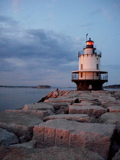
You can't tell someone you live in Maine without being asked about the lighthouses, and I guess you can't really go anywhere in coastal Maine without seeing the whole lot of them anyway. Yes, the lighthouses are alive and abound here - more than 60 of them. Lisa and I encountered our first lighthouse while we were still just visiting Maine - Spring Point Ledge Lighthouse in South Portland. Under a brilliant setting sky with Portland beginning to glow across the Bay, we decided Maine was a pretty great place. It was one of our last days visiting and I had been meaning to call a friend of a friend, Chip, who lived in town. As I was reminding myself to do this we walked out along the rocks to the lighthouse where a young couple sat. I thought, "Wouldn't it be funny if that was Chip? I wonder if that's Chip?" I then turned to Lisa and exclaimed, "Wouldn't it be funny if that was Chip? I wonder if that's Chip?" We then turned toward the shadowed figure A N D .... well, it was Chip. He said he hadn't visited that spot in about four years! Uncanny! Since moving here, we've been wondering whether to call him back or try and run into him unannounced at other historic landmarks (we'll give him a call).


Perhaps the most infamous of all the lighthouses is the Portland Head Light, built between 1787 to 1791 under the directive of the early American poster-boy himself, George Washington. Two hundred eighteen years later, Lisa and I have joined the ranks of visiting the "most photographed lighthouse in America," quite unavoidably. It's actually pretty impressive, and the cliffs are exactly what come to mind when you think New England coast and then say, "New England Coast" to your family and relatives from the midwest. I particularly enjoy the painted lettering on one of the rocks nearby, stating, " Annie C. Maguire Shipwrecked Here, Christmas Eve 1886, R.D." Apparently, everyone aboard the British ship survived despite a massive storm carrying the vessel away piece by piece. The waves and rocks all along the coast are absolutely incredible in their smashing and exploding power. Lisa and I frequently see notices in the more public areas concerning "rogue waves," unexpected wave monstrosities that swallow up the unexpected rogue wave "viewer." Fortunately we still remain, oh worried families! There are countless other lighthouses up and down the coast - we've seen several more since the initial writing of this very blog! From the Bug Light in South Portland to the Marshall Point Light in Port Clyde, we've seen a few. But the tales that go with them will have to wait for future blogs....


Maine. Portland that is...

Howdy all. Mike and I have now followed the winds up North to a land known by many names, including, The Pine Tree State, Vacationland (our favorite), The Evergreen State, Maine: Where America's Day Begins (best to declare loudly while sipping black coffee in the morning), The Border State and The Old Dirigio State (state motto is Dirigio - 'I Lead' in Latin). All of these names are swell, but Mike and I prefer to call the state AWESOME and HOME. We have put down little root tendrils in the rocky soil of Portland, Maine's largest city, and we are hoping they grow into something magnificent, and, preferably with flowers in the Spring. We have a wee little one bedroom house from which we can see Casco Bay and some of the Calendar Islands, so-called because there are 365 of them.


(Casco Bay)

We watch huge cruise ships disgorge their loads of thousands of people into the city to buy artwork, beer and t-shirts. We are also visited by lobster boats, oil ships and ferry boats (some of which go to Nova Scotia!). We like to crawl out our window onto the rickety, rusty fire escape and watch the boats, and at night, the city lights.


(View of a big cruise ship from our window)

The huge "Time and Temperature Building' is also within view it is a neon blinking sign that displays the time and temperature is ever present outside our kitchen window thus rendering obsolete the need for clocks inside the apartment, which is nice, but in the winter we will always be reminded of how freezing cold it is outside (at least we have heat included with the rent!) - brrrr! Our place is in a nice location between the Arts District and Commercial Street on which most of the tourism is focused.


(Congress Street, also called the Arts District - the Portland Museum of Art is barely visible on the far right)


(Commercial Street - main shopping and restaurant area)

The city is peppered with art galleries small and large, not to mention warm, snuggy bars that celebrate live local music almost every night of the week. We've managed to stumble upon a full Irish music party one night at a bar called Blue. Many people were sitting around a large table eating cake and drinking Guinness when suddenly, bagpipes appeared under a hefty bearded man's arm and then a bazouki (an Irish banjo-like instrument) manifested itself in the hands of another man and all around the table instruments popped out of nowhere and were played incredibly well, and all sitting around a table - not even on stage! We've had similar like-encounters of the musical kind at other places around town; hopefully someday soon it will be Mike rendering his musical charms upon a rapt audience sipping on dark delicious Maine brews (Geary's and Bar Harbor's Cadillac Mountain Stout are particularly good). When Mike and I came out here to scope out the scene in early October, Mike's college friend Katie and her German-speaking boyfriend Luke (both of who recently moved to Boston after spending a year teaching English in Thailand) drove up to check out the city with us.


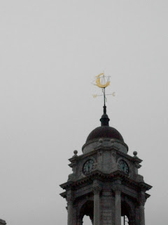
(Top of City Hall)


(Mike and Katie outside Brian Boru)


(Lobster-Kong!!)

We had a blast and decided that Portland offered everything we needed: affordable living, as vibrant an art and music scene as a small city with a population of 62,875 can have, and, of course, a landscape that we suspect is projected down daily from a camcorder in heaven. Yes, it's true, 3,500 miles of coastline to explore, 6,000 lakes and ponds and 17 million acres of forest. Basically, this constitutes all the food our eyes need to survive, and for our bellies, it's fresh and oh soooo good seafood all the time! Now about some jobs...we are confident that they are on the horizon and we're on the hunt!