This entry is VERY late in coming, but, then again, writing it reminds me of the warm, indigo waters of the Aegean while sitting in a chilly apartment in Baltimore! In the name of George Fitz Simmons, the former Simmons family pater familia (a post currently occupied by my dad), the extended Simmons family embarked on a grand family adventure aboard an elegant four masted sailboat, the Windstar, and cruised around Greece and Turkey for 10 days in August, 2010. We were lucky enough to have the gallant company of Mister Mike Marks, banjo player and artist extraordiaire and enthusiastic wearer of flannel.
Indigo waters, white washed villages, ancient ruins and cloudless blue skies greeted us at every stop. Enjoy the slideshow!

Island of Delos, Birthplace of Athena and Apollo, close to Mykonos

Santorini, Greece

Santorini, Greece

Santorini, Greece

Volcano, Santorini, Greece


Deep blue view from Lindos Acropolis

Temple of Apollo

Lindos Acropolis, Temple of Appollo, Rhodes, Greece

Bodrum Castle, Bodrum, Turkey

The Damon brothers soakin' in the sun

Kushadasi

Kushadasi, Turkey

Ephesus, conservation of ancient apartment compound with in-tact wall murals

Sitting on an ancient toilet in the ancient city of Ephesus

The ancient city of Ephesus, Turkey

Hagia Sofia, Istanbul, Turkey

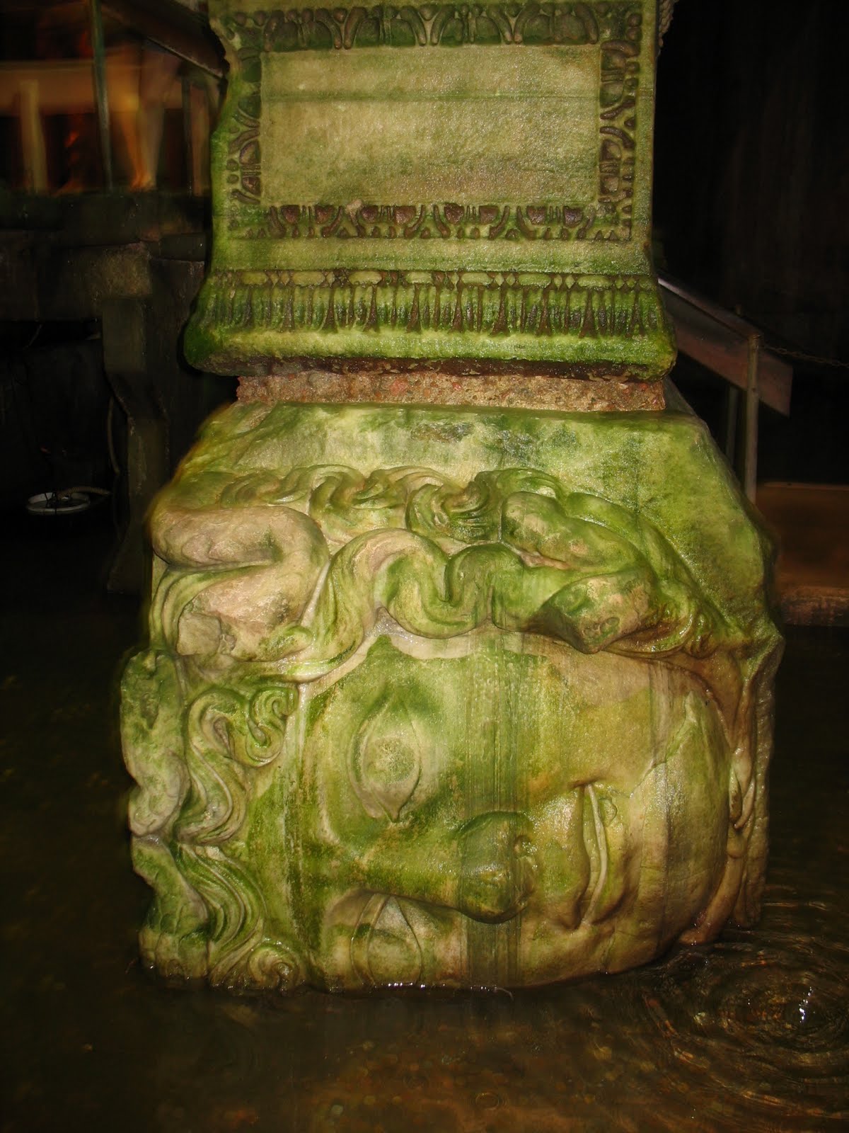
Medusa head in Basilica Cistern (Yerebatan Sarayı), underneath Constantinople,

Blue Mosque, Istanbul, Turkey

View of Istanbul from ship, Blue Mosque and Hagia Sofia visible in distance

Frankfurt airport, during layover, beer at 9am with the family - priceless