The beach had been ravaged the night before by a terrific storm that sucked trees up by their roots and left them to dry in the gray morning. Lobster trap ropes in their myriad colors, sea bird feathers, toys, and plants were intertwined in the roots making cocoons fit for fantasy monsters. What a gorgeous place! We shall return in the spring to swim and try our muscles against the feisty currants.
Wednesday, March 10, 2010
Popham Beach State Park
Popham beach is a thick strand of soft sand studded with tree and ocean (and human) detritus that forms patterns left behind by tides. The beach borders the south side of the mouth of the Kennebec River, which, along with the Morse river, border each end of the beach. Fox and Wood islands are visible offshore and you can walk to Fox Island at low tide (our timing was off!). We were the only people on the beach, a common occurance during the Maine winter, which added to the foggy mystery of the morning.
The beach had been ravaged the night before by a terrific storm that sucked trees up by their roots and left them to dry in the gray morning. Lobster trap ropes in their myriad colors, sea bird feathers, toys, and plants were intertwined in the roots making cocoons fit for fantasy monsters. What a gorgeous place! We shall return in the spring to swim and try our muscles against the feisty currants.


The beach had been ravaged the night before by a terrific storm that sucked trees up by their roots and left them to dry in the gray morning. Lobster trap ropes in their myriad colors, sea bird feathers, toys, and plants were intertwined in the roots making cocoons fit for fantasy monsters. What a gorgeous place! We shall return in the spring to swim and try our muscles against the feisty currants.
Saturday, February 6, 2010
Acadia National Park... in Winter!
Two degrees out. Two degrees outside without the windchill. And there we were, sleeping in the snow, just up the hill from an old New England graveyard on Mt. Desert Island. Though the icy fingers of death were clasping us tight that night, we scoffed at her attempts, dear friends, for we had trekked to Acadia National Park with the sole purpose of braving the elements for a winter camping foray and by God, we were going to do it!
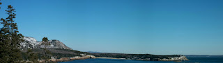
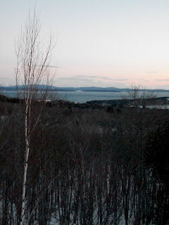
Island view from Cadillac Mountain


Despite the frosty weather, it made for one of the clearest nights yet beheld by us in Maine. And it was far too cold for any ghosts to be wandering from the snow covered graves.

Mike inspecting our green igloo

I don't think I was still smiling when it got to 2 degrees...
We awoke from our icy tomb/two person tent, proceeded immediately to the mini-van and blasted the heat. We warmed up just in time to go back outside into the cold wind and begin hiking Cadillac Mountain. The mountain is the highest point along the eastern seaboard, and thus receives the first glint of sunlight in the United States throughout most of the year. It was named for a man who swindled a Canadian governor into the land rights, naming it Cadillac Mountain under his fantasy for ruling the Land of Cadillac. He made it one year with his wife before tiring of his make-believe kingdom, going on to found the city of Detroit in Michigan (thus, the cadillac automobile is named after him and carries his invented coat of arms insignia). With the exception of two snowmobiles, we were alone on the mountain and watched the sun creep up over the ocean.

The island itself is a patchwork of national park lands and private lands, interspersed with several towns. Acadia National Park encompasses about 45,000 acres, distributed between Mt. Desert Island, Isle au Haut, several smaller islands, and part of the mainland. The landscape is ruggedly eroded and ancient in appearance, having been beaten down by glaciers coming and going over time. the result is a varied land with forests, meadows, wetlands, the ocean (of course), mountains and the only natural fjord in the lower 48 states.

Dawns first light on Eagle Lake
Looking for snow spirits

Evidence of evolution
Most of the park was frozen from our view, though, with areas closed off for the winter. The sacrifice of not seeing all of the park was gaining the solitude of the island. We may as well have had the park to ourselves, with the exception of some locals we very occasionally ran into cross-country skiing or snowshoeing. To go to Acadia in the winter is to have a quiet, meditative experience and see a face of Acadia most tourists never see. Being one of the top ten most visited national parks in the country, and subject to traffic jams from over crowding in the summer, winter was the way to go.

Bass Harbor

Bass Harbor Headlight

Picturesque...
Island view from Cadillac Mountain
Despite the frosty weather, it made for one of the clearest nights yet beheld by us in Maine. And it was far too cold for any ghosts to be wandering from the snow covered graves.
Mike inspecting our green igloo
I don't think I was still smiling when it got to 2 degrees...
We awoke from our icy tomb/two person tent, proceeded immediately to the mini-van and blasted the heat. We warmed up just in time to go back outside into the cold wind and begin hiking Cadillac Mountain. The mountain is the highest point along the eastern seaboard, and thus receives the first glint of sunlight in the United States throughout most of the year. It was named for a man who swindled a Canadian governor into the land rights, naming it Cadillac Mountain under his fantasy for ruling the Land of Cadillac. He made it one year with his wife before tiring of his make-believe kingdom, going on to found the city of Detroit in Michigan (thus, the cadillac automobile is named after him and carries his invented coat of arms insignia). With the exception of two snowmobiles, we were alone on the mountain and watched the sun creep up over the ocean.
The island itself is a patchwork of national park lands and private lands, interspersed with several towns. Acadia National Park encompasses about 45,000 acres, distributed between Mt. Desert Island, Isle au Haut, several smaller islands, and part of the mainland. The landscape is ruggedly eroded and ancient in appearance, having been beaten down by glaciers coming and going over time. the result is a varied land with forests, meadows, wetlands, the ocean (of course), mountains and the only natural fjord in the lower 48 states.
Dawns first light on Eagle Lake
Looking for snow spirits
Evidence of evolution
Most of the park was frozen from our view, though, with areas closed off for the winter. The sacrifice of not seeing all of the park was gaining the solitude of the island. We may as well have had the park to ourselves, with the exception of some locals we very occasionally ran into cross-country skiing or snowshoeing. To go to Acadia in the winter is to have a quiet, meditative experience and see a face of Acadia most tourists never see. Being one of the top ten most visited national parks in the country, and subject to traffic jams from over crowding in the summer, winter was the way to go.
Bass Harbor
Bass Harbor Headlight
Picturesque...
Tuesday, January 12, 2010
Morse Mountain
I only went out for a walk and finally concluded to stay out till sundown, for going out, I found, was really going in. ~ John Muir, 1913


One of the self-proclaimed 'geezers' at the coffee shop saddled over to me one early morning and generally inquired as to how I came into existence and what brought me here to heaven to work in a coffee shop. I told him that I was 'in transition' a state I now realize will be my perpetual fate. But, I did manage to get out the fact that, "Well, sir, I'm here because of the land. In part." Well kid!, he said. You should check out...and he gave me a treasure map of Maine, including Morse Mountain. Rest assured you will see more of his advice later in the blog. He was a retired businessman turned nature lover/hiker and drinker of half decaf half dark because, "Anything else would kill me."


The place is absolutely beautiful. The full name is the Bates-Morse Mountain Conservation Area (500+acres)/ It's a nature preserve managed by the Harward Center of Bates College for environmental research and education. The mountain summitt is one of the highest points on the mid-Maine coast, rising 117 ft above sea level. A convienient by-product of the place is its unwitty ability to calm and nurture the soul of any visitor who finishes the 4 mile trek to the mountain summitt, through gorgeous saltwater marshes and out to Seawall Beach.


In every walk with nature, one receives far more than he seeks. ~ John Muir
One of the self-proclaimed 'geezers' at the coffee shop saddled over to me one early morning and generally inquired as to how I came into existence and what brought me here to heaven to work in a coffee shop. I told him that I was 'in transition' a state I now realize will be my perpetual fate. But, I did manage to get out the fact that, "Well, sir, I'm here because of the land. In part." Well kid!, he said. You should check out...and he gave me a treasure map of Maine, including Morse Mountain. Rest assured you will see more of his advice later in the blog. He was a retired businessman turned nature lover/hiker and drinker of half decaf half dark because, "Anything else would kill me."
The place is absolutely beautiful. The full name is the Bates-Morse Mountain Conservation Area (500+acres)/ It's a nature preserve managed by the Harward Center of Bates College for environmental research and education. The mountain summitt is one of the highest points on the mid-Maine coast, rising 117 ft above sea level. A convienient by-product of the place is its unwitty ability to calm and nurture the soul of any visitor who finishes the 4 mile trek to the mountain summitt, through gorgeous saltwater marshes and out to Seawall Beach.
In every walk with nature, one receives far more than he seeks. ~ John Muir
Sunday, January 3, 2010
Mackworth Island
When Mike and I first visited Portland, we took a ride on an adorable antique narrow gauge railcar that worked its way across the city waterfront. The railcar was run by the Maine Narrow Gauge Railway Co. & Museum and our guide was either a direct descendent or illegitimate son of Santa Clause. It was our first long view of the waterfront and we were intrigued by all the Calendar Islands. What secrets did they hide and how the heck did we get out to them?

View from the narrow gauge
After nestling into the city for a few months, we finally decided to make our way to an island that promised birding, beautiful trails and views of Portland and Casco Bay. Mackworth island was our destination, it is the current site of the Baxter School for the Deaf which lies on the island's interior; the 1.25 mile nature trail encircles the outer perimeter. The island is a legislated bird sanctuary and is connected to the city of Falmouth by a drive-able causeway. A parking lot is situated at the end of the road that hikers and day visitors can park at free of charge. A wacky dude in the visitor booth will tell you jokes and hand you a map/visitor guide that outlines the bird and animal life and history of the island.

Causeway to Mackworth

Sunlit hiking trail through pine forest


Apparently, a man with the sweet name of Sir Ferdinando Gorges (whom Fort Gorges in Casco Bay is named after) gave the island to his deputy Arthur Mackworth and island has retained his name. The visitor guide will inform you that one of Maine's most illustrious governors, Percival Baxter, once called the island his home and even built a notable pet cemetery for his beloved hounds which still stands today. The island is located along the mouth of the Presumpscott River that was an important early native trade route for the Wabanaki Confederacy. Long before any white governors made themselves king of the island, a Wabanaki Chief, Cocoawesco, claimed the honor. The Baxters donated native artifacts they found on the island to the Maine State Museum.

Baxter's pet cemetery. Sometimes you can see the ghosts of the hounds walking along the trail at dusk...not really!
The most magical part of the island, however, are the fairy houses!


View from the narrow gauge
After nestling into the city for a few months, we finally decided to make our way to an island that promised birding, beautiful trails and views of Portland and Casco Bay. Mackworth island was our destination, it is the current site of the Baxter School for the Deaf which lies on the island's interior; the 1.25 mile nature trail encircles the outer perimeter. The island is a legislated bird sanctuary and is connected to the city of Falmouth by a drive-able causeway. A parking lot is situated at the end of the road that hikers and day visitors can park at free of charge. A wacky dude in the visitor booth will tell you jokes and hand you a map/visitor guide that outlines the bird and animal life and history of the island.
Causeway to Mackworth
Sunlit hiking trail through pine forest
Apparently, a man with the sweet name of Sir Ferdinando Gorges (whom Fort Gorges in Casco Bay is named after) gave the island to his deputy Arthur Mackworth and island has retained his name. The visitor guide will inform you that one of Maine's most illustrious governors, Percival Baxter, once called the island his home and even built a notable pet cemetery for his beloved hounds which still stands today. The island is located along the mouth of the Presumpscott River that was an important early native trade route for the Wabanaki Confederacy. Long before any white governors made themselves king of the island, a Wabanaki Chief, Cocoawesco, claimed the honor. The Baxters donated native artifacts they found on the island to the Maine State Museum.
Baxter's pet cemetery. Sometimes you can see the ghosts of the hounds walking along the trail at dusk...not really!
The most magical part of the island, however, are the fairy houses!
Saturday, January 2, 2010
Burnt Meadow Mountain
This particular adventure was planned after I obtained the holy grail of hiking guides, 50 Hikes in the Maine Mountains, from the Portland Public Library. Each little circle on a map of Maine indicated a glorious destination to which hikers migrate during different times of the year. Its a good thing Mike and I are so hard core - extreme seasonal fluctuations are no impediment to our massive muscles and steel minds. One circle in particular drew our attention because of its intriguing name, Burnt Meadow Mountain, and its promise of gorgeous views and semi-difficult terrain over a 2.4 mile hike that would take us about 2 hours, giving Mike ample time to paint en plein air and me ample time to explore the mountain nooks and crannies.


The history of Burnt Meadow and the adjacent town of Brownfield is tragic. (Source: www.nelsap.org/me/burntmeadow.html) In 1947 a large forest fire destroyed much of the area and town, resulting in the saying, "The Summer That Maine Burned" and, of course, 'Burnt Meadow Mountain'. It is estimated that 85% of the town was completely incinerated. Brownfield does have a cute little history museum that we plan to visit someday.
The town did not succeed in attracting industry back to the area so they decided to have a go at starting a ski resort. A state grant of $6200 was given to the town to study the prospects of a ski area and the report suggested that the area, "could become one of the top ski areas in Maine."
More money was allocated in 1967, unfortunately, heavy snows and generally terrible weather slowed down construction for years, although a 3400 foot lift was installed (which still stands in dilapidated form). The area finally opened for the 1971-72 season but more bad weather and competition from nearby already established resorts caused building and expansion to cease on Burnt Meadow. Ownership of the mountain changed a few times but it never did well as a ski resort and finally shut down in 1982.

Mountain summit


Today you wouldn't know the mountain was once burnt to ashes or made into a ski resort unless you catch glimpses of the old t-bar lift. Nature has taken back its own. Thank god for it - the place is incredible and the Presidential's can be seen in clear view from the top. The colors were what stopped us in our tracks. As you can tell, they were taken in late fall, not January, but we'll get back soon for a winter scape!


We took the blue blazed trail to the top but there were other trails with different colored blazes


On our way back to Portland we stopped to check out a beautiful pond as it was nearing twilight
The history of Burnt Meadow and the adjacent town of Brownfield is tragic. (Source: www.nelsap.org/me/burntmeadow.html) In 1947 a large forest fire destroyed much of the area and town, resulting in the saying, "The Summer That Maine Burned" and, of course, 'Burnt Meadow Mountain'. It is estimated that 85% of the town was completely incinerated. Brownfield does have a cute little history museum that we plan to visit someday.
The town did not succeed in attracting industry back to the area so they decided to have a go at starting a ski resort. A state grant of $6200 was given to the town to study the prospects of a ski area and the report suggested that the area, "could become one of the top ski areas in Maine."
More money was allocated in 1967, unfortunately, heavy snows and generally terrible weather slowed down construction for years, although a 3400 foot lift was installed (which still stands in dilapidated form). The area finally opened for the 1971-72 season but more bad weather and competition from nearby already established resorts caused building and expansion to cease on Burnt Meadow. Ownership of the mountain changed a few times but it never did well as a ski resort and finally shut down in 1982.
Mountain summit
Today you wouldn't know the mountain was once burnt to ashes or made into a ski resort unless you catch glimpses of the old t-bar lift. Nature has taken back its own. Thank god for it - the place is incredible and the Presidential's can be seen in clear view from the top. The colors were what stopped us in our tracks. As you can tell, they were taken in late fall, not January, but we'll get back soon for a winter scape!
We took the blue blazed trail to the top but there were other trails with different colored blazes
On our way back to Portland we stopped to check out a beautiful pond as it was nearing twilight
Subscribe to:
Posts (Atom)